
The School of Earth Science at University of North West Himalayas (UNWH), Thano, Dehradun
is a vibrant academic hub dedicated to exploring the dynamic interactions between the Earth’s physical
systems and human activities. Situated in the lap of the Himalayas, the school provides students with a
unique opportunity to study Geography, Geology, Environmental Science, and cutting-edge technologies like
Remote Sensing and GIS in a real-world geospatial laboratory.
The School of Earth Science at University of North West Himalayas (UNWH), Thano, Dehradun
Tagline - Geography, Geoscience, Geospatial, and Environment for Green Futures.
To cultivate scientific knowledge, technical skills, and environmental awareness through interdisciplinary education and research in Earth system sciences, ensuring sustainable development and resilience for future generations.
The School of Earth Science offers a range of undergraduate, postgraduate, diploma, and certificate-level programs that blend theory with hands-on experience:
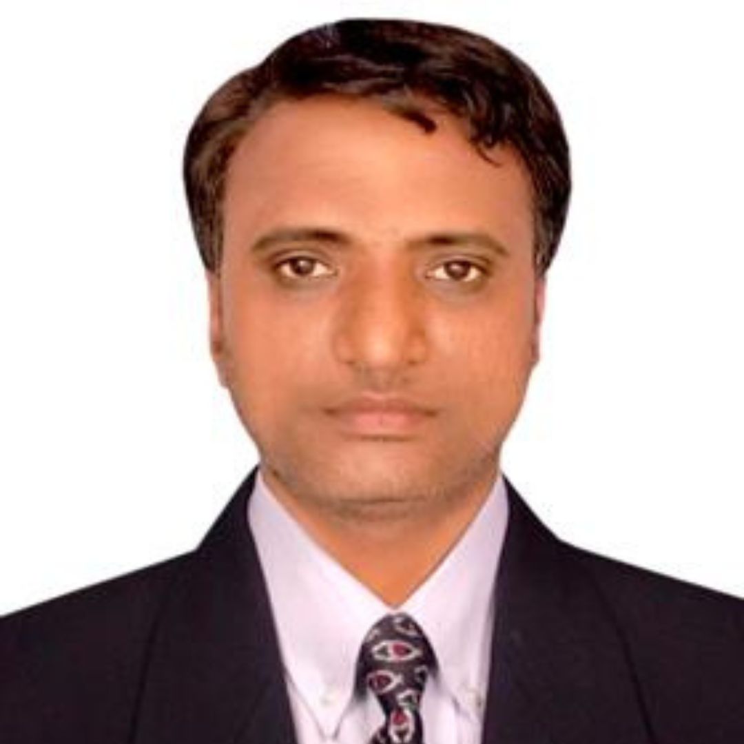
Dr Surendra Pal Singh has received his PhD (Jan 2009 to Feb 2015) from Geomatics Engineering Section, Civil Engineering Department, Indian Institute of Technology, Roorkee, (IIT-Roorkee), India. He received M.Tech degree (2006-2008 Academic Year) in Geomatics Engineering, from Indian Institute of Surveying & Mapping, Survey Of India, Government of India, collaboration with Jawaharlal Nehru Technological University JNTU, Hyderabad, India. He has also Graduated and Post graduate in Environmental Science from University of Allahabad, Prayagraj, India. His schooling is from Samthar (Native Town) Jhansi, UP.
He is expert in various Geomatics Engineering techniques for Engineering & Non-engineering applications. Since 2015 to 2024, he worked in Ethiopian government universities. Currently, he is working as Dean & Professor at School of Earth Science in University of North West Himalayas (UNWH), Dehradoon, Uttarakhand (India).
He has published 5 books and more than 30 research papers in reputed international journals and international conferences. His research interest is Geomatics techniques (Remote sensing, GIS, Surveying & Mapping, GNSS-GPS, Digital Photogrammetry, Laser Scanning, UAV Mapping etc techniques) for various engineering and non-engineering applications.
He is member of academic societies such as the Indian National Cartographic Association (INCA), Hyderabad (Life Member), Indian Society of Remote Sensing, (ISRS), Dehradun (Life Member), Indian Society of Geomatics, (ISG), Ahmedabad (Life Member), Indian Water Resources Society (IWRS) WRD&M, IIT-Roorkee (Life Member), International Global Navigation Satellite Systems Society (IGNSS) (Annual Member). He is also doing research and community service projects for socio-economic development.
| S.No. | University/Organization | Designation | Time Duration |
|---|---|---|---|
| 1 | Indian Institute of Technology (IIT), Roorkee. India | Research Scholar Geomatics Engineering Section, Civil Engineering Department | Jan 2009 to Feb 2015 (6 years) |
| 2 | Wachemo University, Hossana City, Ethiopia | Assistant Professor Civil & Geomatics Engineering Department (2275 US Dollar per month salary) | Oct 2015 to July 2019 (4 Academic Years) |
| 3 | Wollega University, Nekemte City, Ethiopia | Assistant Professor Surveying Engineering Department (3610 US Dollar per month salary) | Feb 2020 to July 2024 (4 Academic Years) |
| 4 | Wollega University, Nekemte City, Ethiopia | Associate Professor | Promoted as Associate Professor in May 2024 |
| 5 | Jigyasa The Curiosity (JTC), IAS Civil Service Academy, Kota (Rajasthan) | Academic Director Faculty of UPSC (For Science & Tech, Disaster Management, Ecology & Environment) | 12 August 2024 to July 2025. |
| 6 | University of North West Himalayas (UNWH), Dehradoon. | Dean & Professor | 01 August 2025 to Till Date. |
I have approximately Eight (9) year teaching experience & Six (6) Year Research experience (Total 15 Years) Experience in Teaching, Research & Development in Civil engineering, Geomatics engineering techniques such as Surveying Engineering (Basic Surveying, Advance Surveying), Geomatics, Photogrammetry, Remote Sensing and Geographical Information System (GIS), GNSS- GPS (Global Positioning System), Environmental Science & Engineering etc., related subjects.
1. Basic Surveying,
2. Advanced Surveying,
3. Environmental Study.
4. Water Treatment
5. Sewage Disposal & Treatment,
6. Introduction to Photogrammetry,
7. Analytical Photogrammetry
8. Introduction to Environmental Planning,
9. Cadastral Surveying
10. Research skill & Methodology in Engineering,
11. Introduction of GPS-GNSS
1.Environmental Ecology,
2. Environmental Remote Sensing,
3. Geodesy & Positioning,
4. Land Information System,
5. Advanced Geomatics,
6. Statistics for Geomatics Engineers
1. Geomatics techniques for various applications (Agriculture, Water Resources, Rural & City Planning etc)
2. Photogrammetry, (Mainly Applications of Digital Close Range Photogrammetry)
3. Laser scanning, (Laser scanning applications for Terrestrial mapping and digital scene reconstructions)
4. GIS, (GIS Mapping for various Engineering & Non Engineering Applications)
5. Geodesy, (Gravimetric measurements for various applications)
6. 3D City modeling. (For Urban and regional city planning)
7. Use of modern android based Smart mobile phone as a Geomatics mapping tool.
| S.No. | Organisation | Period | Details of Training |
|---|---|---|---|
| 1 | Center for Environmental Education(CEE), Ministry of Environment & forest, Govt. of India. | 10.02.04 11.02.04 | Biomedical waste management status Analysis & Planning for future |
| 2 | Central Ground Water Board, Ministry of water Resources, Govt. of India | 23.03.04 24.03.04 | Artificial recharge to ground water. |
| 3 | Biological Product lab Allahabad University, Allahabad | 18.12.04 21.12.04 | Organic farming. |
| 4 | Center for Social forestry & Eco Rehabilitation(CSFER)Allahabad, Ministry of Environment & forest, Govt. of India. | 22.03.05 23.03.05 | Research & development project on Jatropha plant. |
| 5 | Survey of India, Hyderabad; Ministry of Science & technology, Govt. of India. | 20.09.06 22.09.06 | Photogrammetry & Remote Sensing – Overview for policy makers. |
| 6 | Survey of India, Hyderabad; Ministry of Science & technology, Govt. of India. | 09.10.06 13.10.06 | Modern survey instruments & techniques. |
| 7 | Jawaharlal Nehru Technological University (JNTU) Hyderabad &NRDMS (Dept. of Science & Technology) Govt. of India. | 12.02.07 24.02.07 | Two weeks short term program on Geospatial Technologies |
| 8 | Advanced Training Institute, Hyderabad; Ministry of Labour & Employment, Govt. of India. | 14.03.08 29.03.08 | Two weeks Advanced training in “Assembling and maintenance of P.C.Hardware. |
| 9 | Osmania University- Hyderabad (AP) | 17.06.09 07.07.09 | Three week SERC school on “Atmospheric Effect on GPS and Local Area Augmentation System (LASS)”. |
| 10 | Indian Institute of Technology-Roorkee (IITR), Uttarakhand, India. | 23.08.2010 27.08.2010 | One week short term course on Advance Geoinformation System |
| 11 | Indian Institute of Technology-Roorkee (IITR), Uttarakhand, India | 05.11.2012 10.11.2012 | Short term training course on “Prediction and mitigation of climate change impacts using space and agrometeorology based techniques”. |
| 12 | Indian Institute of Technology-Roorkee (IITR), Uttarakhand, India | 11.11.2013 16.11.2013 | Training programme on “Modeling sustainable agriculture under changing climate” |
| 13 | Indian Institute of Technology Roorkee (IITR), Uttarakhand, India. | 30.05.2014 | 3D Modeling with FARO Focus 3D Laser Scanner |
| 14 | Indian Institute of Remote Sensing (IIRS), Indian Space Research Organization (ISRO), Dehradun, Uttarakhand, India | 27.01.2015 27.03.2015 | 14th, IIRS Outreach Programme on "Applications of Remote Sensing and Geographical Information System for Natural Resources |
“Using Rational Polynomial Coefficients (RPC) to generate digital elevation models – a comparative
study”, (2009), , Applied GIS, Vol. 05, Issue 02, pp. 1-11. (SCOPUS Index)
View Article
“Accuracy Improvement of ASTER Stereo Satellite Generated DEM Using Texture Filter”, (2010),
December, Geo-spatial Information Science, Vol. 13, Issue 04, pp. 257-262. (SCOPUS Index)
View Article
“A Text to Speech System for Hindi using English Language”, International Journal of Computer
Science and Technology (IJCST), Vol. 02, Issue 03, September 2011, ISSN: 2229- 4333(Print), ISSN:
0976-8491(Online). (UGC)
View
Article
“Design and Calibration of Multi Camera setup for 3D City modeling,” (2013), International Journal
of Engineering Research & Technology (IJERT), Vol. 02, Issue 05, May. (SCOPUS Index)
View Article
“Image Based 3D Modeling of Campus (Department of Civil Engineering, IIT Roorkee, Uttarakhand,
India) by Using SketchUp”(2013), International Journal of Advanced Civil Engineering and
Architecture Research, September, Vol. 02, Issue 01, pp. 65-71, Article ID Tech-168. (SCOPUS Index)
View Article
“Virtual 3D Campus Modeling by using Close Range Photogrammetry”, (2013), American Journal of Civil
Engineering and Architecture, Vol.01, No. 06, pp. 200-205. December, doi: 10.12691/ajcea-1-6-9.
(SCOPUS Index)
View
Article
“3D Scene Reconstruction from Video Camera for Virtual 3D City Modeling” (2014), American Journal of
Engineering Research (AJER), Vol.03, Issue 01, January, pp-140-148. (SCOPUS Index)
View Article
“Image based Virtual 3D Campus modeling by using CityEngine”, (2014), American Journal of
Engineering Science and Technology Research, Vol. 02, No.01, January, pp- 01-10, ISSN: 2327-8269
(Online). (SCOPUS Index)
View Article
“Virtual 3D City Modeling : Techniques and Applications”, (2013), ISPRS International Archives of
the Photogrammetry, Remote Sensing and Spatial Information Sciences, Vol. XL-2/W2, pp. 73-91,
doi:10.5194/isprsarchives-XL-2-W2-73-2013 (SCOPUS Index)
View Article
“Image based 3D City modeling: Comparative study”, (2014), ISPRS International Archives of the
Photogrammetry, Remote Sensing and Spatial Information Sciences, XL-5, 537-546,
doi:10.5194/isprsarchives-XL-5-537-2014. (SCOPUS Index)
View Article
“A New Approach towards Image Based Virtual 3D City Modeling by using Close Range Photogrammetry”,
(2014), ISPRS International Annals of the Photogrammetry, Remote Sensing and Spatial Information
Sciences, Vol. II-5, pp. 329-337. doi:10.5194/isprsannals-II-5-329-2014. (SCOPUS Index)
View Article
“Computing the average body mass index: A study with systematic sampling using auxiliary
information”, Mathematical Problems in Engineering, Hindawi Publication, Volume 2022, Article ID
9291313, 7 pages, https://doi.org/10.1155/2022/9291313 19th Jan 2022, Corresponding author. (SCOPUS
Index)
View Article
“Analysis and Interpretation of Rainfall Trend using Mann Kendall's and Sen's Slope Method”, Indian
Journal of Ecology, (2021) 48(2): 453-457, Published-16 Aug 2021. (SCOPUS Index)
View Article
Assessing the potentials of Bamboo and sheep wool fiber as sustainable construction materials: A
review, Materials Today: Proceedings Volume 47, Part 14, 2021, Pages 4484-4489,
https://doi.org/10.1016/j.matpr.2021.05.322, Published-28 May 2021, (Elsevier, SCOPUS Index)
View Article
SVM-based compliance discrepancies detection using remote sensing for organic farms, Arabian Journal
of Geosciences https://doi.org/10.1007/s12517-021-07700-4 Published-28 Sep 2021, (SCOPUS Index).
View Article
Greetings from the School of Earth Sciences at the University of North West Himalayas (UNWH), Dehradun!
It gives me immense pleasure to welcome you to one of the most dynamic and future-oriented academic environments in the field of Earth and Environmental Sciences. Nestled in the lap of the Himalayas, our university offers a unique setting to explore, understand, and protect our planet through rigorous academic training and hands-on field exposure.
At the School of Earth Sciences, we are committed to nurturing scientific curiosity and developing sustainable solutions to address the global environmental and geospatial challenges of our time. Our curriculum integrates classical concepts with modern technological tools such as GIS, GPS-GNSS, Remote Sensing, Geospatial intelligence, Photogrammetry and environmental monitoring systems.
We offer a wide range of undergraduate and postgraduate programs in Geography, Geology, Environmental Science and Remote Sensing & GIS.
Our courses are designed in alignment with national-level competitive examinations such as UGC-NET, GATE (Geomatics), and Civil Services (Geography Optional), providing our students with a strong foundation for academic and professional excellence.
The faculty at the School of Earth Sciences comprises experienced educators, researchers, and professionals who bring rich interdisciplinary knowledge, strong industry-academia linkages, and a student-centered approach to learning. We are working together with Tagline-
"Geography, Geoscience, Geospatial and Environment for Green Futures."
As the Dean, I invite you to embark on this transformative journey with us—to explore the wonders of the Earth, to understand the science behind its changing landscapes, and to become stewards of our environment.
Let us learn together, research responsibly, and innovate sustainably—for a better, greener future for sustainable development.
Warm regards,
Prof. Dr Surendra Pal Singh
(BSc., MSc, MTech., PhD IIT-Roorkee)
| Name | Qualification | Publications |
|---|---|---|
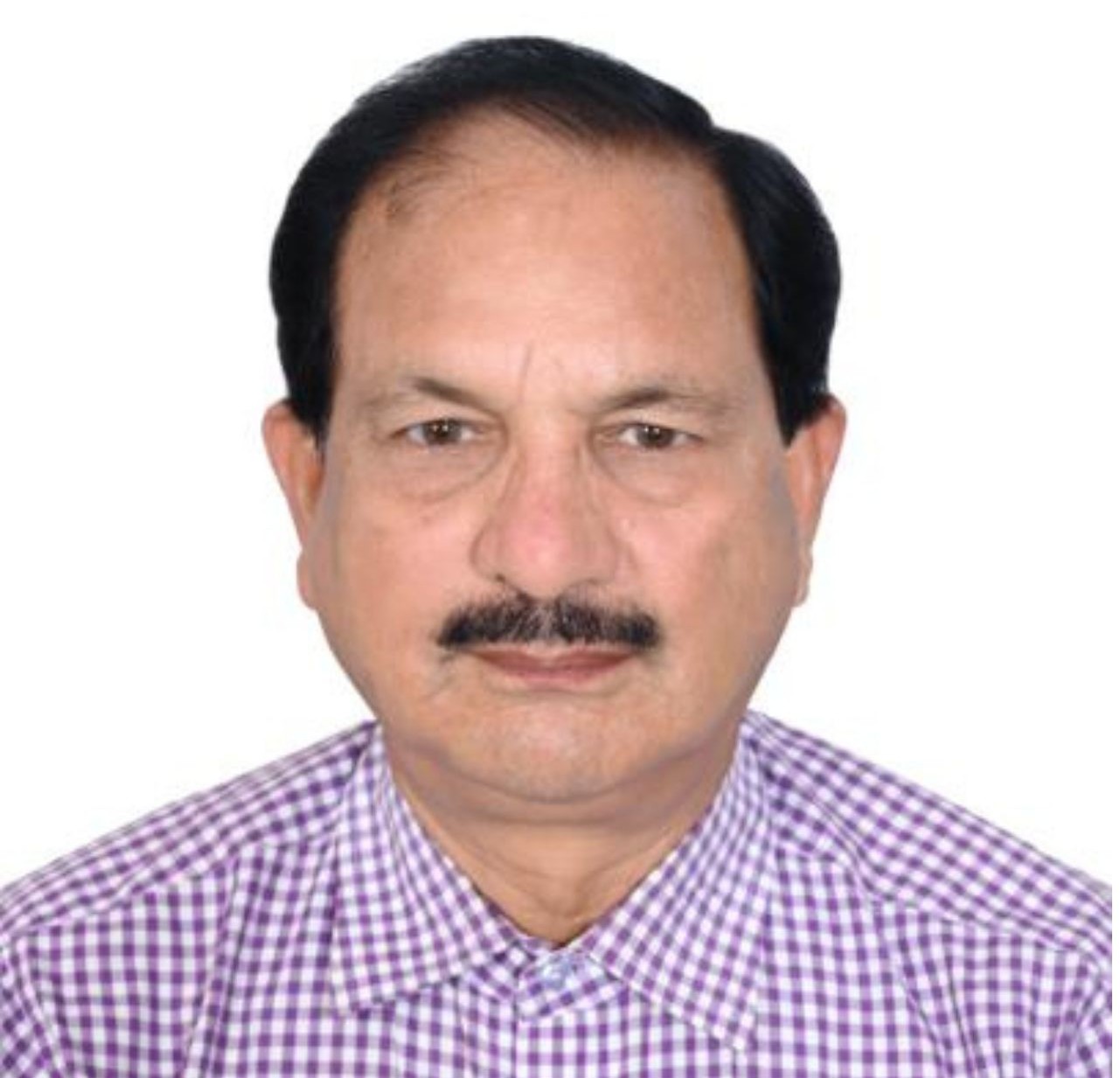
Dr. D. D. Chauniyal |
M.A., Ph.D. (Geography) P.G. Diploma in Remote Sensing and GIS from IIRS, Dehradun 4 months GIS training course 2 months cartography and mapping course 1 month Neo-tectonic course from IIRS, Dehradun |
|
Graduates from the School of Earth Science are placed in sectors such as
The University of North West Himalayas (UNWH) offers a dynamic blend of academic excellence and competitive exam preparation through its specialized undergraduate and postgraduate programs. At the UG level, students can pursue B.Sc. (Hons.) in Geography and B.Sc. (Hons.) in Geology, uniquely integrated with UPSC Civil Services preparation, where these subjects are taught as optional papers with a strong conceptual and analytical foundation. At the PG level, the university offers M.Sc. in Environmental Science and M.Sc. in Geography, MSc Geology, these subjects aligned with UGC-NET/JRF exam preparation to empower future educators and researchers. Additionally, the M.Sc. in Remote Sensing & GIS program is tailored with a focus on GATE (Geomatics Engineering) exam preparation, combining technical mastery with strategic guidance. UNWH ensures that students not only graduate with strong academic credentials but are also competitively positioned for national-level examinations and prestigious careers in science, education, research, and civil services.
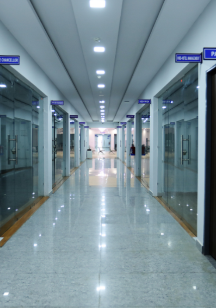
Located in Dehradun, the gateway to the Himalayas and a center of environmental and geospatial research, the school offers unparalleled exposure to ecological diversity and earth sciences in action.
School of Earth Science
University of North West Himalayas (UNWH)
Village- Sangaon Bhagwanpur, Dharkot Road, Thano
Dehradun – 248143, Uttarakhand (India)